-
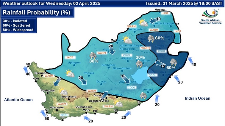
The South African Weather Service graphic showing the outlook for April 2-3, 2025.
Meteorologist Azwi Tuwani says the cold snap experienced in parts of the country is caused by clouds covering the systems, that are moving along the coastal areas and pushing in cooler air to the interior.
Gauteng, Free State and the Eastern Cape have been experiencing cooler weather conditions this week.
Today, Johannesburg’s maximum temperatures are predicted to at 22 Degrees Celsius.
⛈️Weather outlook for Thursday & Friday, 3- 4 April 2025: Partly cloudy & warm, but cool along the east coast & adjacent interior with isolated to scattered showers & thundershowers over the central & eastern areas of the country. #saws #weatheroutlook #southafricanweather pic.twitter.com/IJ2uBl6G1Y
— SA Weather Service (@SAWeatherServic) April 1, 2025
Tuwani says, “It was cooler and there was some wind blowing, also blowing that cooler air in the interior, so that cooler air is coming from the oceans and entering the interior of South Africa.”
He says, “It is normal for it to happen whenever we have cloud covering during the day it doesn’t get as hot, the temperatures will be cooler or remain warm but not hot.”
Tuwani says Gauteng will experience the usual winter temperatures.
“The winter so far, we are still seeing it is going to be normally cold as we normally get here in Gauteng, but as we get closer that is where we will see the effects and may maybe we can be able to say it is going to be longer we do see it is going to be a normal winter.”
Related video | SA Weather Report l 02 April 2025:


