


-
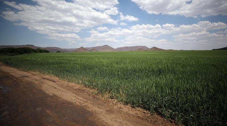
Fields of wheat are seen on farmland on the banks of the Orange River near Vanderkloof, South Africa
Rising water levels are posing a risk to crops in the Lower Orange River region in the Northern Cape. Several roads and low-lying bridges have been closed as the water in the Orange River rises to levels last seen during the flood of 2011 in the area.
Water released from the overflowing Vaal and Gariep dams into the Orange River system has contributed to the surging levels.
Farmers in the Lower Orange river region say the rising water levels could threaten their vineyards. Some vineyards are under water as water released from the Vaal and Gariep dams reaches the Orange river. The flow at Augrabies falls were at 4200 cumecs yesterday. #SABCNews pic.twitter.com/RU1ec0joZJ
— Ulrich Hendriks (@UlrichHendriks) May 4, 2025
Johannes Louw, a concerned farmer in Upington, says the floods are already impacting lucerne production and could pose a threat to next year’s grape harvest if the situation worsens.
“Lucerne will drown. Lucerne will not survive, but the positive side is that the grapes have been harvested, so there are no losses for grapes. It can only be for next year if there are damages to the farm. The big concern is that the water can cross the road and the Kakamas will not be able to reach, and the water will damage the grapes inside when it is overflowing the canal.”
The rising water levels have caused panic amongst farmers, with some fearing the worst. Chairperson of Orange River Producers Association, Gabriel Viljoen says some fields are under water, and if the water remains in the field for two weeks, they will have to replant, which requires a lot of money.
“It has a big impact due to the water volumes which have risen over the past few days in the lower wineyards that is already covered in water. It is the same as you take oxygen from you. Wineyards get hurt. So after a period of two weeks the vines basically dies, then you have to replace them at a huge cost.”
Vice President of Agri Northern Cape, Wiaan Van Rensburg says if more water flows from the Orange river it can cause damage to infrastructure.
“If the water levels rise because of the flood walls that were not done correctly after the 2011 floods, the water can overflow into agricultural land and it can cause infrastructure problems, if that flood wall breaks and the wineyards can be washed away from the ground. That will be a much bigger problem. more like the 1998 floods, and we don’t want this water high water to go to that level.”
The flow on Sunday reached 4300 cubic meters per second. Typically, the flow ranges between 30 and 50 cubic meters per second.
Authorities are monitoring the situation closely as the potential for further agricultural damage and community disruption grows.